

Description
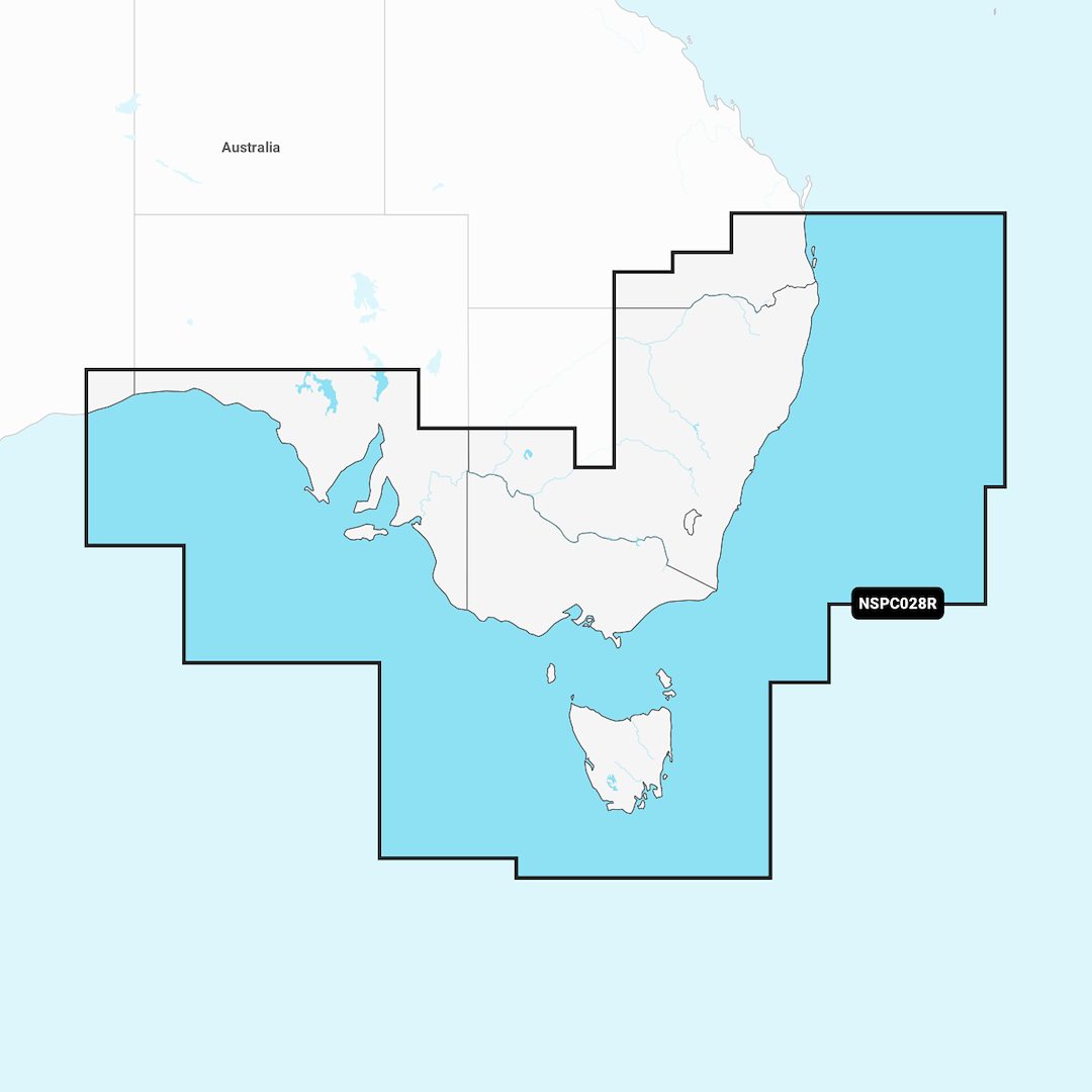
GARMIN CARTOGRAPHY 010-C1282-20 Compatible With Chart Plotters; Detailed Coverage Of Eastern And Southern Coast Of Australia From Brisbane To Nullabor National Park; Region Code: NSPC028R; On SD/ Micro-SD Card; With Auto Guidance Technology High-Resolution Relief Shading High-Resolution Satellite Imagery Aerial Photography 3D Fisheye View 3D Marinereye View And Dynamic Lake Level
Brand : GARMIN CARTOGRAPHY
ManufacturerPart : 010-C1282-20
UPC : 753759289768
Length : 0.95 inches
Width : 0.95 inches
Height : 0.08 inches
Weight : 0.05 lbs
Case Quantity : 1
Prop65 Toxicity : C
Compatible With Chart Plotters; Detailed Coverage Of Eastern And Southern Coast Of Australia From Brisbane To Nullabor National Park; Region Code: NSPC028R; On SD/ Micro-SD Card; With Auto Guidance Technology High-Resolution Relief Shading High-Resolution Satellite Imagery Aerial Photography 3D Fisheye View 3D Marinereye View And Dynamic Lake Level

