

Description
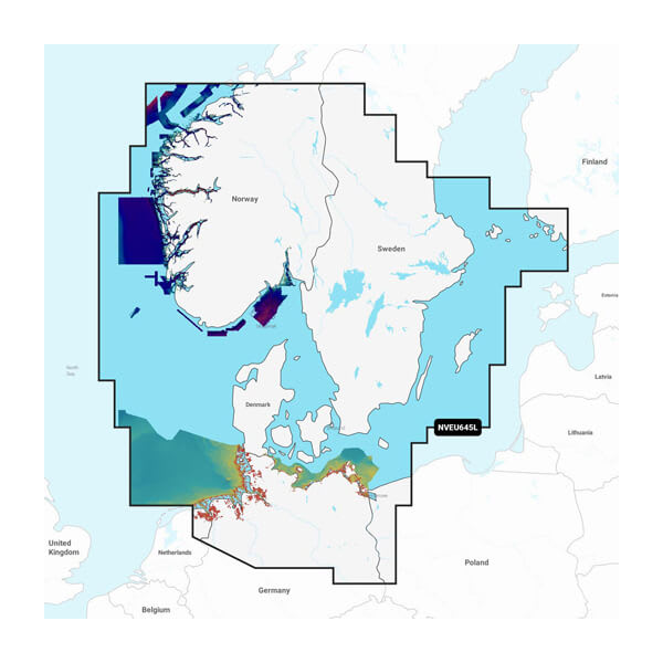
GARMIN CARTOGRAPHY 010-C1274-00 Compatible With Chart Plotters; Detailed Coverage Of Skagerrak And Kattegat And The Approaches To Them; Region Code: NVEU645L; On SD/ Micro-SD Card; With Auto Guidance Technology Relief Shading High-Resolution Satellite Imagery Aerial Photography 3D Fisheye View 3D Marinereye View
Brand : GARMIN CARTOGRAPHY
ManufacturerPart : 010-C1274-00
UPC : 753759290481
Length : 0.95 inches
Width : 0.95 inches
Height : 0.08 inches
Weight : 0.05 lbs
Case Quantity : 1
Prop65 Toxicity : C
Compatible With Chart Plotters; Detailed Coverage Of Skagerrak And Kattegat And The Approaches To Them; Region Code: NVEU645L; On SD/ Micro-SD Card; With Auto Guidance Technology Relief Shading High-Resolution Satellite Imagery Aerial Photography 3D Fisheye View 3D Marinereye View

