Description
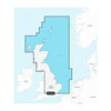
GARMIN CARTOGRAPHY 010-C1231-20 Compatible With Chart Plotters; Detailed Coverage Of Northeast Coast Of Great Britain From The Mouth Of The Thames To The Isle Of Lewis Including The Orkney Islands The Shetland Islands And North Sea Offshore Charts; Region Code: NSEU003R; On SD/ Micro-SD Card; With Auto Guidance Technology High-Resolution Relief Shading High-Resolution Satellite Imagery Aerial Photography 3D Fisheye View 3D Marinereye View And Dynamic Lake Level
Brand : GARMIN CARTOGRAPHY
ManufacturerPart : 010-C1231-20
UPC : 753759289256
Length : 0.95 inches
Width : 0.95 inches
Height : 0.08 inches
Weight : 0.05 lbs
Case Quantity : 1
Prop65 Toxicity : C
Compatible With Chart Plotters; Detailed Coverage Of Northeast Coast Of Great Britain From The Mouth Of The Thames To The Isle Of Lewis Including The Orkney Islands The Shetland Islands And North Sea Offshore Charts; Region Code: NSEU003R; On SD/ Micro-SD Card; With Auto Guidance Technology High-Resolution Relief Shading High-Resolution Satellite Imagery Aerial Photography 3D Fisheye View 3D Marinereye View And Dynamic Lake Level