
Description
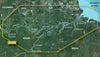
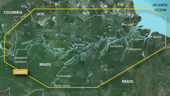
GARMIN CARTOGRAPHY 010-C1066-20 Compatible With Chart Plotters; Region Code: HXSA009R; Detailed Coverage Of Amazon River From Benjamin Constant Brazil To The Atlantic Ocean The Madeira River To Porto Velho And Portions Of The Tapajos And Para Rivers; On SD/Micro-SD Card; With Integrated Garmin/Navionics Content Auto-Guidance Depth Range Shading Detailed Contours And Shallow Water Shading
Brand : GARMIN CARTOGRAPHY
ManufacturerPart : 010-C1066-20
UPC : 753759978730
Length : 8 inches
Width : 6 inches
Height : 1.5 inches
Weight : 0.5 lbs
Case Quantity : 1
Prop65 Toxicity : C
Compatible With Chart Plotters; Region Code: HXSA009R; Detailed Coverage Of Amazon River From Benjamin Constant Brazil To The Atlantic Ocean The Madeira River To Porto Velho And Portions Of The Tapajos And Para Rivers; On SD/Micro-SD Card; With Integrated Garmin/Navionics Content Auto-Guidance Depth Range Shading Detailed Contours And Shallow Water Shading