Description
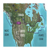
GARMIN CARTOGRAPHY 010-C1019-20 Compatible With Chart Plotters; Region Code: HXCA600X; Detailed Coverage Of East Coast Of North America From Nain NL To Raritan Bay; On SD/Micro-SD Card; With Integrated Garmin/Navionics Content Auto-Guidance Depth Range Shading Shallow Water Shading Detailed Contours And NOAA Raster Cartography
Brand : GARMIN CARTOGRAPHY
ManufacturerPart : 010-C1019-20
UPC : 753759095758
Length : 8 inches
Width : 6 inches
Height : 1.5 inches
Weight : 0.5 lbs
Case Quantity : 1
Prop65 Toxicity : C
Compatible With Chart Plotters; Region Code: HXCA600X; Detailed Coverage Of East Coast Of North America From Nain NL To Raritan Bay; On SD/Micro-SD Card; With Integrated Garmin/Navionics Content Auto-Guidance Depth Range Shading Shallow Water Shading Detailed Contours And NOAA Raster Cartography