

Description
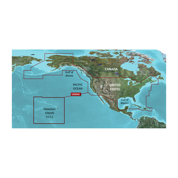
GARMIN CARTOGRAPHY 010-C1018-20 Compatible With Chart Plotters; Region Code: HXUS604X; Detailed Coverage Of The Eastern Coast Of The U.S From Key West FL To The Canadian Border And The Western Coast From The Mexican Border To Puget Sound Alaska Hawaii; On SD/Micro-SD Card; With Integrated Garmin/Navionics Content Auto-Guidance Depth Range Shading Shallow Water Shading Detailed Contours And NOAA Raster Cartography
Brand : GARMIN CARTOGRAPHY
ManufacturerPart : 010-C1018-20
UPC : 753759095789
Length : 8 inches
Width : 6 inches
Height : 1.5 inches
Weight : 0.5 lbs
Case Quantity : 1
Prop65 Toxicity : C
Compatible With Chart Plotters; Region Code: HXUS604X; Detailed Coverage Of The Eastern Coast Of The U.S From Key West FL To The Canadian Border And The Western Coast From The Mexican Border To Puget Sound Alaska Hawaii; On SD/Micro-SD Card; With Integrated Garmin/Navionics Content Auto-Guidance Depth Range Shading Shallow Water Shading Detailed Contours And NOAA Raster Cartography

