

Description
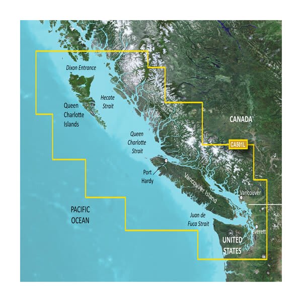
GARMIN CARTOGRAPHY 010-C0701-00 Compatible With Chart Plotters; Region Code: VCA501L; Detailed Coverage Of North American Coast From Grey's Harbor WA In The US North To Dixon Entrance; On SD/Micro-SD Card; With Integrated Garmin/Navionics Content Auto-Guidance High-Resolution Shading 3D Views Shaded Relief Satellite And Aerial Imagery
Brand : GARMIN CARTOGRAPHY
ManufacturerPart : 010-C0701-00
UPC : 753759068813
Length : 8 inches
Width : 6 inches
Height : 1.5 inches
Weight : 0.5 lbs
Case Quantity : 1
Prop65 Toxicity : C
Compatible With Chart Plotters; Region Code: VCA501L; Detailed Coverage Of North American Coast From Grey's Harbor WA In The US North To Dixon Entrance; On SD/Micro-SD Card; With Integrated Garmin/Navionics Content Auto-Guidance High-Resolution Shading 3D Views Shaded Relief Satellite And Aerial Imagery

